A mysterious land in the embrace of mountains
The Naryn Region is located in the southeastern part of the Kyrgyz Republic. To the east it borders the Issyk-Kul Region, to the north the Chui Region, to the west the Jalal-Abad Region, and to the south it shares a state border with the People’s Republic of China.
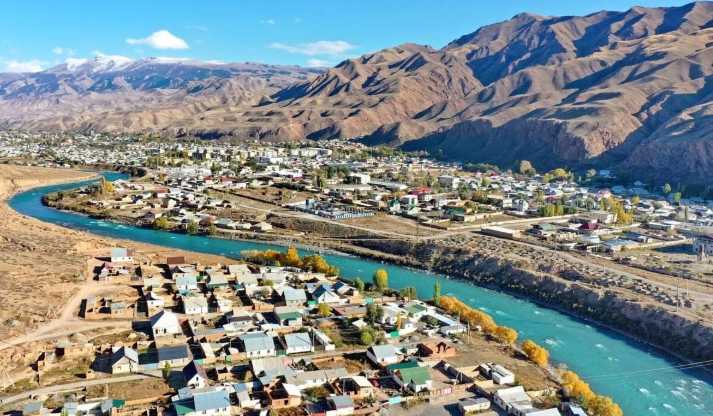
The administrative and territorial structure of the Naryn Region includes five districts: Ak-Talaa, At-Bashi, Jumgal, Kochkor, and Naryn. The administrative center of the region and its largest city is Naryn.
The city of Naryn was founded in 1865 as a military fortification on the site of a settlement located along a trade route toward Kashgar.
The total area of the Naryn Region is 45.2 thousand square kilometers, which is approximately one quarter of the territory of the Kyrgyz Republic. The population of the region is 287,000 people.
Population distribution by administrative units is as follows:
Naryn city - 40.0 thousand people
Ak-Talaa District - 32.5 thousand
At-Bashi District - 54.9 thousand
Jumgal District - 44.3 thousand
Kochkor District - 66.2 thousand
Naryn District - 49.1 thousand people
In terms of ethnic composition, the Naryn Region is predominantly monoethnic. About 99 percent of the population are representatives of the Kyrgyz nationality.
Chon-Tuz
A unique health resort located in the southwest of the Kochkor District. It is a horizontal gallery inside Mount Kok-Too, measuring 500 meters in length, 5 meters in width, and 3 meters in height, situated at an altitude of 2,100 meters above sea level.
In the harsh mountain climate, the microclimate of the salt mine has a beneficial effect on the human body. 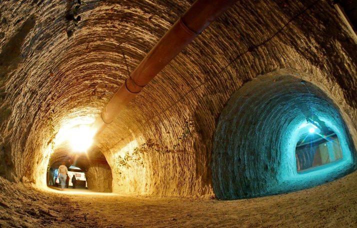
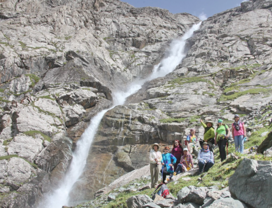
The Largest Waterfall in Central Asia
The largest waterfall in Central Asia is located in the At-Bashi District. The height of the waterfall reaches 320 meters, and it is situated at an altitude of 3,220 meters above sea level.
The waterfall is located 20 kilometers from the village of Bash-Kayindy.
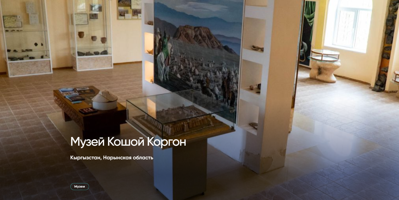
Koshoy-Korgon
Koshoy-Korgon is a unique historical and architectural monument located 12 kilometers west of the village of At-Bashi in the Naryn Region of the Kyrgyz Republic.
In the 7th–10th centuries, the fortress was used as a defensive structure by Turkic rulers. The name “Koshoy-Korgon” translates from the Kyrgyz language as “Fortress of Koshoy” and is associated with the legendary warrior, a character of the epic hero Manas. According to folk legends, the fortress was built by Koshoy himself.
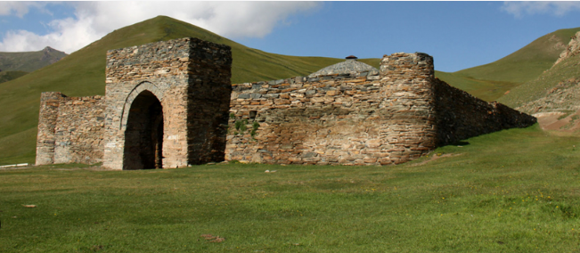
The Largest Caravanserai in Central Asia
The Naryn Region is famous for its harsh yet majestic nature. One of its main treasures is considered to be the Tash-Rabat Caravanserai - an ancient stone structure hidden among the mountains.
In the past, it was an important stop along the Great Silk Road, where trade routes and cultures intersected. Its massive walls, intricately designed corridors, and domed halls still preserve the atmosphere of lively trade and remind visitors of the region’s rich historical heritage.
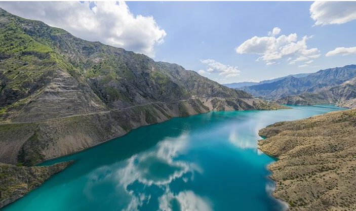
Naryn River
The Naryn River is one of the largest water arteries of Central Asia. It flows through the territory of Kyrgyzstan and Uzbekistan and, merging with the Kara Darya River, forms the mighty Syr Darya.
The total length of the river is 807 kilometers, and the area of its basin reaches 59.9 thousand square kilometers. The Naryn originates at the confluence of the Big Naryn and Small Naryn rivers, carrying waters from high mountain regions and giving life to vast valleys of the region.
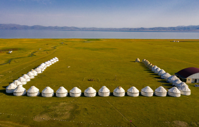
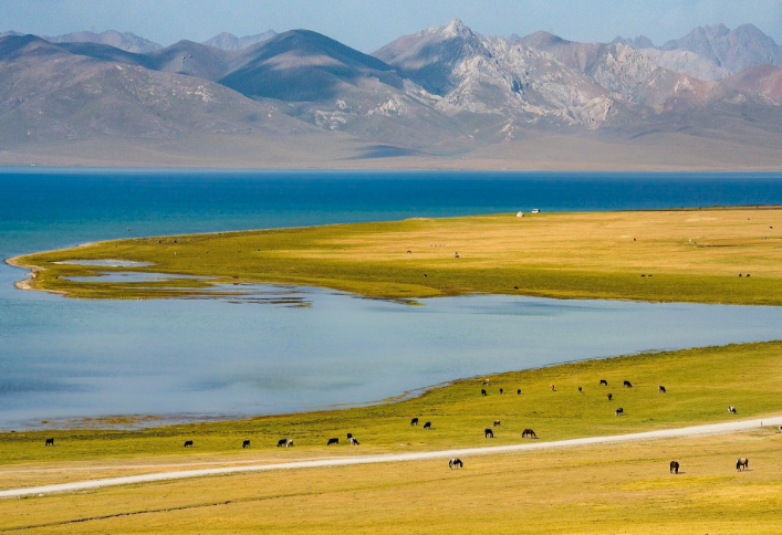
Son-Kul Lake
Son-Kul is the second largest lake in Kyrgyzstan, located at an altitude of 3,016 meters above sea level. Its length reaches 29 kilometers, and its width is 18 kilometers. The maximum depth of the lake is 13.2 meters.
The average water temperature is about -3.5°C. In summer, the water warms up to 11°C, and in winter it freezes at -20°C. The lake is covered with ice from September to June, creating a breathtaking winter highland landscape.
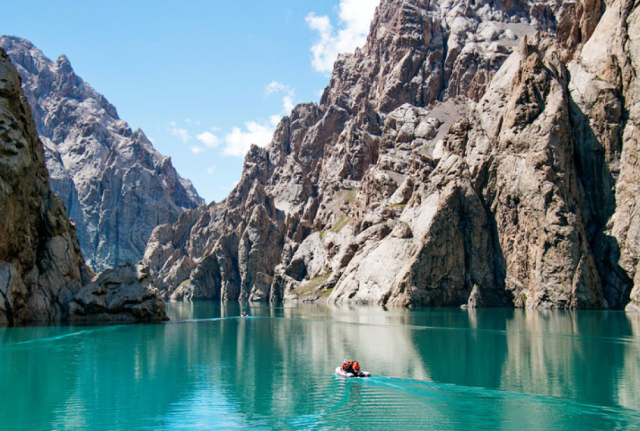
Kol-Suu Lake
Syrduu Kol-Suu is a high-altitude glacial lake located in the southeastern part of the Naryn region. Its waters shimmer in shades of blue and green, perfectly blending with the surrounding mountains and creating an almost magical atmosphere.
The lake lies between rocky cliffs and is partially hidden from view - to see it fully, one must walk across the field. The length of Kol-Suu reaches 9 kilometers, while its width varies from 500 meters to 2 kilometers.
Sometimes the lake disappears and then reappears, making it truly mysterious - hence its name “Syrduu,” which means “Mysterious.”
Chatyr-Kul Lake
Chatyr-Kul is a high-altitude lake located at an elevation of 3,530 meters, between the slopes of the Torugart Pass and At-Bashi Range. The lake is 23 kilometers long and 11 kilometers wide, with a depth of up to 20 meters.
In winter, the lake is covered with thick ice, and in spring, meltwater from glaciers fills it with crystal-clear water, creating a picturesque and majestic landscape surrounded by high mountains.
Макаланы жүктөгөн: - Омурова Зуура
Share information
Sign up to post a comment!
Popular articles
Currently the most read posts on the site
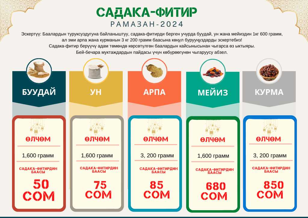
Ramadan 2024 - Fitr sadaqah …
The Spiritual Administration of Muslims of Kyrgyzstan has determined the …
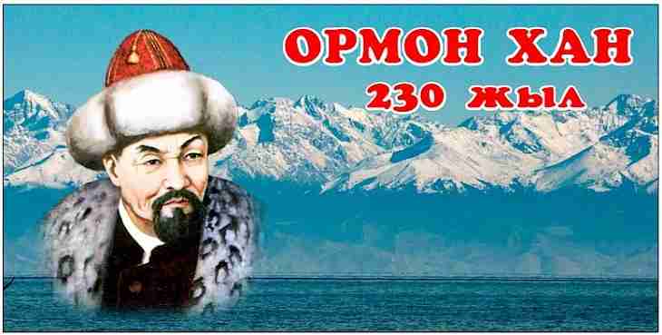
230 years of Ormon Niyazbek.
This year we are celebrating the 230th anniversary of Ormon …
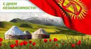
Independence Day of the Kyrgyz …
On the occasion of the Independence Day of the Kyrgyz …